Foster City · The question everyone asks first
The city is made of the bay.
Foster City sits on Brewer Island, a salt marsh diked for dairy farming in the 1890s and then raised about six feet with sand dredged out of San Francisco Bay. Every house here stands on engineered fill behind a levee. That is not a warning. It is a fact worth understanding.
Dredged from the San Bruno Shoals
Over roughly three years
27 April, on a 98 per cent vote
01 · How it was made
A dredge running around the clock for years.
T. Jack Foster Sr., a retired Texas developer, took an option in 1958 on land David Bohannon had judged undevelopable, and bought 2,600 acres in 1960. The master plan, by the engineering firm Wilsey, Ham & Blair, was approved by San Mateo County in 1961.
The fill came out of the bay. A dual-ladder dredge worked the San Bruno Shoals around the clock, moving something on the order of twelve to sixteen thousand cubic yards a day, and the excavation that produced the sand became the lagoon that runs through the middle of the city. Soils consultants Dames & Moore handled subsidence and drainage. Nine numbered neighbourhoods were planned, and they were not built in numerical order.
The first residents moved in on 7 March 1964. Charles Zerbe, a San Francisco firefighter, bought the first house for $23,500. Eichler prices ran from $28,500 to $30,950 — the top of the city’s range.
02 · The levee
Raised six feet, finished in 2024.
Foster City depends on a levee. The original dikes date from the 1890s; Caltrans reinforced them in 1983 and a concrete stormwall added eighteen inches in the 1990s.
In 2018 the city passed Measure P with close to 81 per cent support, authorising a $90 million general obligation bond to raise and rebuild roughly six and a half miles of bayfront. Construction began in October 2020. All flood-protection elements were complete by July 2023 and the project reached final completion in February 2024. It is a mix of earthen levee, hybrid sheet pile and concrete floodwall, designed by Schaaf & Wheeler and built by Shimmick, and the Bay Trail along the crest was rebuilt to eighteen feet wide.
The bond is repaid through an assessed-value-based property tax over thirty years, not a flat parcel charge, so what any given owner pays depends on their assessed value. Published figures for the rate differ between the city’s own pages, so check your actual tax bill rather than any number you read online, including ours.
03 · Flood status
Current as of September 2026 — and it just changed.
This is the part where accuracy matters more than confidence, so here is exactly what we know and how we know it.
The City of Foster City states that FEMA has certified the levee as providing protection from the one per cent annual chance flood, that land inside the city limits is classified Zone X, and that mandatory flood insurance is not required for federally backed mortgages. The city submitted a Letter of Map Revision in February 2024 seeking exactly that classification.
A Letter of Map Revision for the City of Foster City, case 24-09-0381P, was published in the Federal Register with a date of modification of 11 September 2026. That is very recent. The Federal Register notice lists the case and the date but does not describe what changed, and we have not seen the determination letter itself.
So: do not rely on this page, and do not rely on a flood-zone statement written before 11 September 2026. Pull the current effective FIRM panel for the parcel from FEMA’s Map Service Center, and ask Foster City Public Works — which is the designated map repository — for the determination letter. We do this for our own clients as a matter of course, and we would rather tell you how to check than hand you a number that may be eight days stale.
One thing that is worth saying plainly and is not in dispute: property behind an accredited levee is not property without flood risk. FEMA and the city both recommend voluntary coverage. That is a considered decision, not a formality.
04 · The lagoons
Publicly owned, brackish, and seasonal.
The lagoon system is owned and operated by the Estero Municipal Improvement District, formed in March 1960 and governed by the Foster City City Council. Day-to-day maintenance falls to Public Works.
The water is a mixture of San Francisco Bay water and stormwater collected across the city — brackish, not fresh and not treated. The lagoon doubles as the city’s stormwater detention basin, sized for a storm severe enough to be expected roughly once a century, and water is pumped out to the bay. Levels are held between one and two feet above a reference elevation in summer and lowered in mid-November ahead of winter storms, which is worth knowing if you are touring waterfront property in January and wondering why the water looks low.
For waterfront parcels: the lagoon bed is publicly owned, no part of a private dock may extend into it, a minimum forty-five foot unobstructed waterway must be maintained, and docks require an architectural review permit under the city code. Dock size limits vary with waterway width. The city has also been drafting new objective waterfront design standards covering docks, setbacks and views, discussed at Planning Commission study sessions in April and September 2026 and not yet adopted. Anyone buying with dock plans should confirm the current position with Community Development directly.
05 · What a disclosure package here contains
Things you will not see elsewhere on the Peninsula.
A Foster City package carries the standard California Natural Hazard Disclosure items, and then several that most Peninsula cities do not produce: the FEMA flood-zone status on a map revised this month; the Measure P bond on the tax bill; the Estero Municipal Improvement District as an overlay service provider; and, on waterfront parcels, the frontage maintenance obligation, the dock rules and the public ownership of the lagoon bed.
Seismic hazard is the item to look at closely. Foster City sits on hydraulic fill and bay mud, and local reporting has described most of the city as carrying high liquefaction hazard. A California Geological Survey liquefaction zone designation has two consequences: it triggers disclosure, and it requires a site-specific geotechnical investigation before certain building permits are issued. We could not confirm the current zone designation from the state mapping service and will not assert it — check it on the CGS hazard mapping tool for the specific parcel, and expect it to matter if you plan to add on.
There is one further fact worth having. A 2018 study in Science Advances on Bay Area land subsidence noted that parts of Foster City built on engineered landfill are subsiding. No source we could find publishes a rate for Foster City, and we are not going to invent one. It is a real finding and it is not a number we can give you.
Questions we get asked
The ones that come up every time.
- Is Foster City in a flood zone?
- The City states that land within the city limits is classified Zone X and that flood insurance is not mandatory for federally backed mortgages, following FEMA certification of the levee. A Letter of Map Revision for Foster City took effect on 11 September 2026. Because that is so recent, confirm the current designation for the specific parcel on FEMA’s Map Service Center and with Foster City Public Works before relying on it.
- Do I need flood insurance in Foster City?
- The City states it is not mandatory for federally backed mortgages. Both FEMA and the City nonetheless recommend voluntary coverage, because land behind an accredited levee is protected rather than risk-free. Whether to carry it is a decision for you and your insurer, and it should be a considered one.
- What did the levee project do?
- Measure P, passed in 2018 with close to 81 per cent support, authorised a $90 million bond to rebuild about six and a half miles of bayfront levee, raising it roughly six feet using earthen levee, sheet pile and concrete floodwall. Construction ran from October 2020, with flood-protection elements complete in July 2023 and final completion in February 2024.
- Is the ground stable? What about liquefaction?
- Foster City is built on hydraulic fill and bay mud. Local reporting has described most of the city as carrying high liquefaction hazard, and geologists quoted have said the risk can be mitigated. A liquefaction zone designation triggers both a disclosure requirement and a site-specific geotechnical investigation before certain permits. Check the parcel on the California Geological Survey hazard mapping tool rather than relying on a general statement.
- Who owns the lagoons?
- The Estero Municipal Improvement District, formed in 1960 and governed by the Foster City City Council. The lagoon bed is publicly owned, which is why no private dock may extend into it and why dock construction needs an architectural review permit.
- What is the water in the lagoons?
- A mixture of San Francisco Bay water and stormwater collected across the city — brackish, not fresh and not treated. The system doubles as the city’s stormwater detention basin and is drawn down in mid-November ahead of the winter storm season.
What we can do for you
Things worth asking us for.
Check your parcel
We will pull the current flood determination for your address.
The FEMA maps for Foster City were revised on 11 September 2026, so anything written before that date — including a disclosure package assembled earlier in the year — may describe a map that is no longer in force. Send us the address and we will pull the effective FIRM panel for that parcel and tell you what it says.
We are not engineers, insurers or a flood authority. We read you the current map and point you at Public Works for the determination letter.
Photographed here
Our own photographs, on the ground.
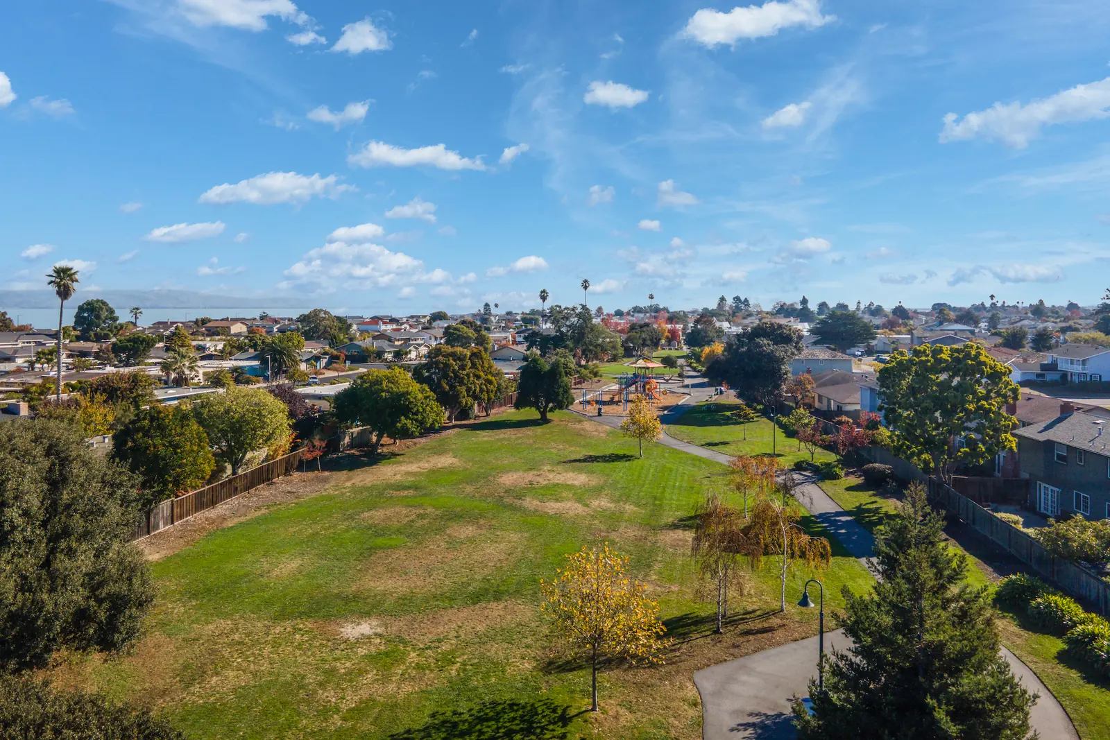
Boyenga Team listing photography, Foster City, November 2021.
Before they list
Two hundred houses, none of them on an all-Eichler block.
Because Eichler was sold scattered lots here, there is no street to watch and no tract to farm — a listing can come and go without anyone who wanted it ever seeing it. We keep a list and we write to it only when something actually happens — no volume, no drip campaign.
Talk to us
We check the ground on every Foster City house we touch.
Flood classification, levee status, liquefaction zoning and the disclosure package are all parcel-specific and all checkable. We do that work before we price a house here, and we are happy to do it for one we are not selling.
The other clusters